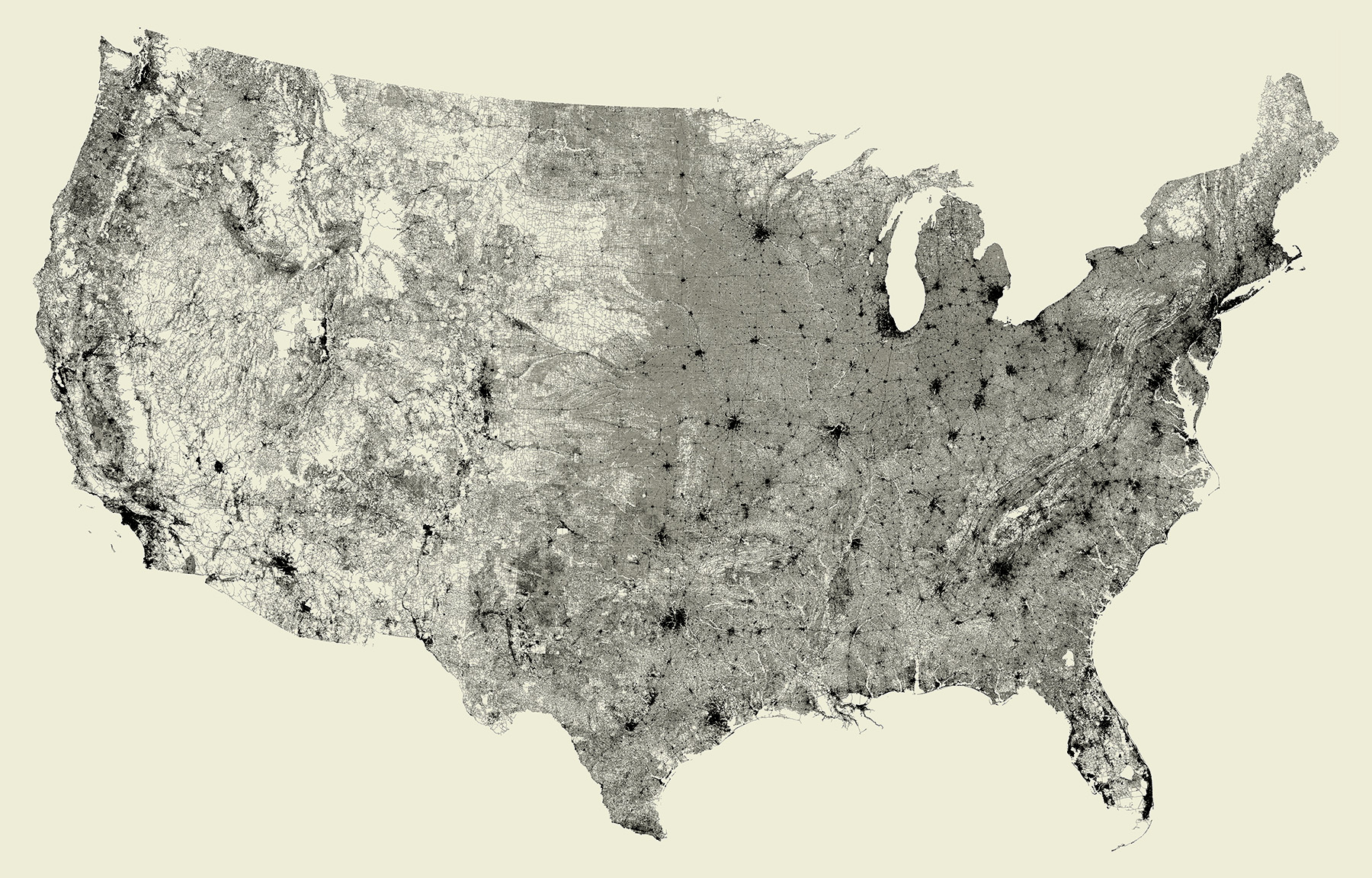
All Streets
All of the streets in the United States: an image of 26 million individual road segments. No other features (such as outlines or geographic features) have been added to this image, however they emerge as roads avoid mountains, and sparse areas convey low population. This began as example code I wrote for a student in the fall of 2006. Only the lower 48 states are seen here, because Alaska and Hawaii complicate things quite a bit and have too few roads to define their shape. More details and related blog posts (from 2008) can be found here.
After starting Fathom in 2010, we created a massive version for an exhibition, and with many requests we started selling poster-sized prints, with the proceeds donated to charity. (You can read about the printing process here.) One day in 2014 it showed up on Reddit, leading to a huge number of sales (and equally huge donation to the Somerville Homeless Coalition!) We also created versions for other countries and U.S. states around that time, and dug deeper into some of the things we found. In 2022, we closed the print shop to focus on other projects.